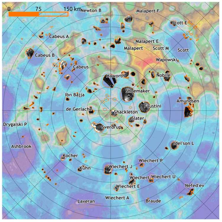
Whats a DTM/DEM ?

A Digital Elevation Model (DEM) is a 3D representation of elevation data for terrain or objects, applicable not just to Earth but also to moons, asteroids and other planetary bodies. It is a representation of elevation data of the underlying terrain or overlaying objects. This is commonly used in Geographic information systems (GIS) to study the geography and, topographic analysis of the terrain.
For all intensions and purposes, they usually look like a black and white images where the brighness values depict the relative height values. More information and explanation of DEM: What is a digital elevation model (DEM)?

Member discussion