Post-Landing Terrain Assessment of the Intuitive Machines-1 Landing Site
Last month, Intuitive Machines achieved a landmark touchdown in the Moon’s southern polar region, marking the United States as the first country to accomplish such a landing. However, despite this significant achievement, the Nova-C lander tipped over due to several technical issues. Until the actual landing, the precise target site had largely been ‘unknown,’ aside from a vague announcement specifying Malapert- A as the landing area. This post provides a series of analyses on the actual landing site.
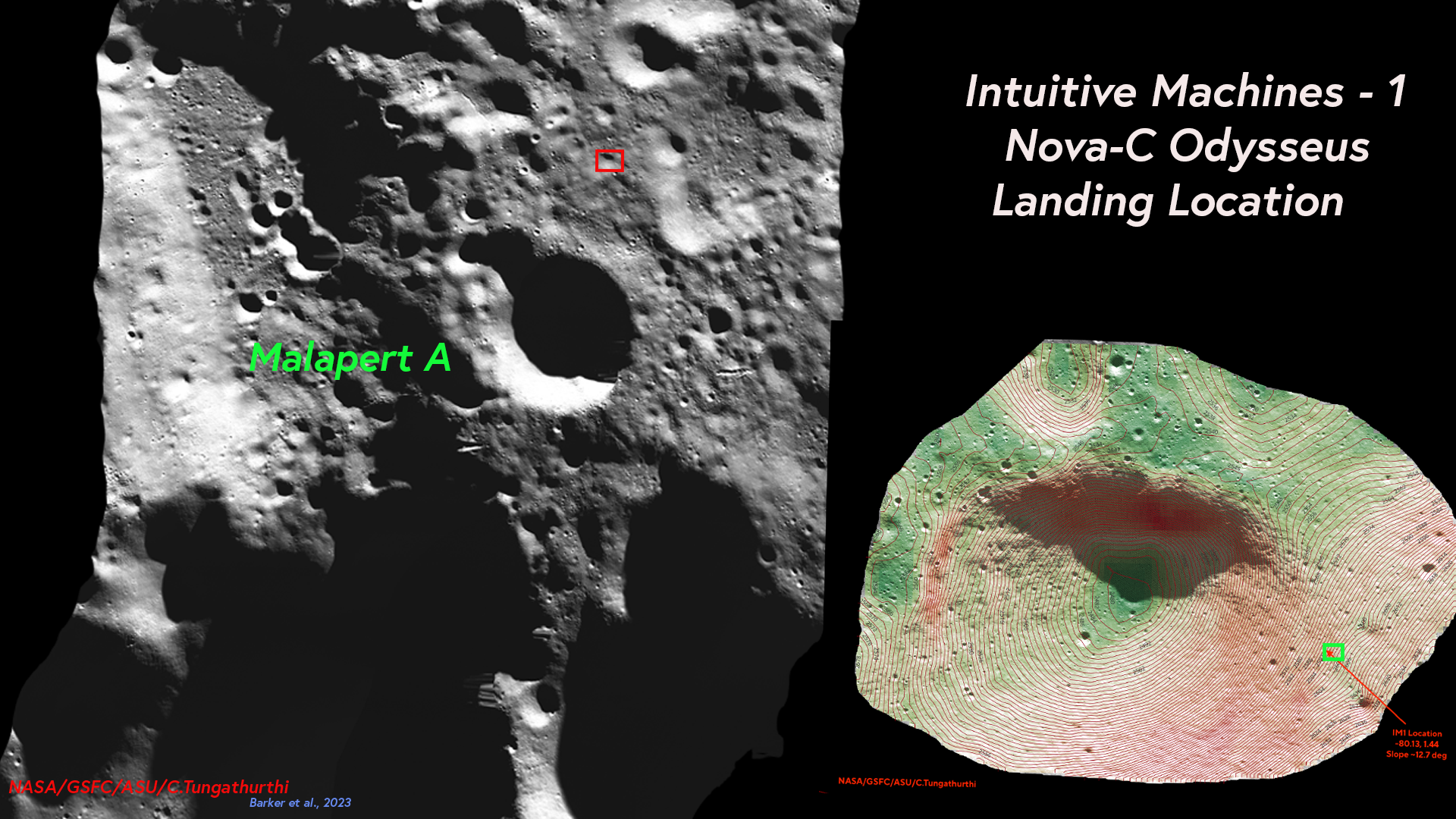
Intuitive Machines announced that the lander's final touchdown coordinates were at (-80.13, 1.44), confirming it landed in the Southern Polar region.
Images from NASA’s Lunar Reconnaissance Orbiter Camera team confirmed Odysseus completed its landing at 80.13°S and 1.44°E at a 2579 m elevation. After traveling more than 600,000 miles, Odysseus landed within 1.5 km of its intended Malapert A landing site, using a contingent… pic.twitter.com/CaMSSO4Gfb
— Intuitive Machines (@Int_Machines) February 26, 2024
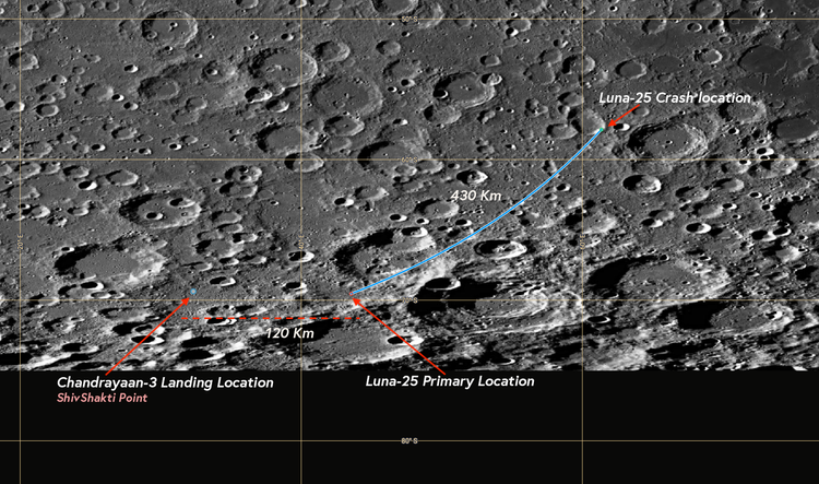
Amid much anticipation, it was previously announced that IM-1 would land at Malapert A, though this was not the actual intended landing site. The Nova-C lander eventually touched down approximately 30 km east of it, on the rim of a degraded crater. The landing site was on a slope of about 12.7° and at an elevation of 2587 meters, according to my terrain analysis. This finding is generally in line with-in the error margin of the officially released figures.
From the LRO blog,
Odysseus came to rest at 80.13°S, 1.44°E, 2579 m elevation, within a degraded one-kilometer diameter crater where the local terrain is sloped at a sporty 12°
My terrain analysis utilizes the elevation and slope model of the South Pole derived from LOLA, at a resolution of 20 meters per pixel. The data products
LDEM_80S_20MPP_ADJ and LDSM_80S_20MPP_ADJ from Barker et al., where used for assessing the topography of this location.
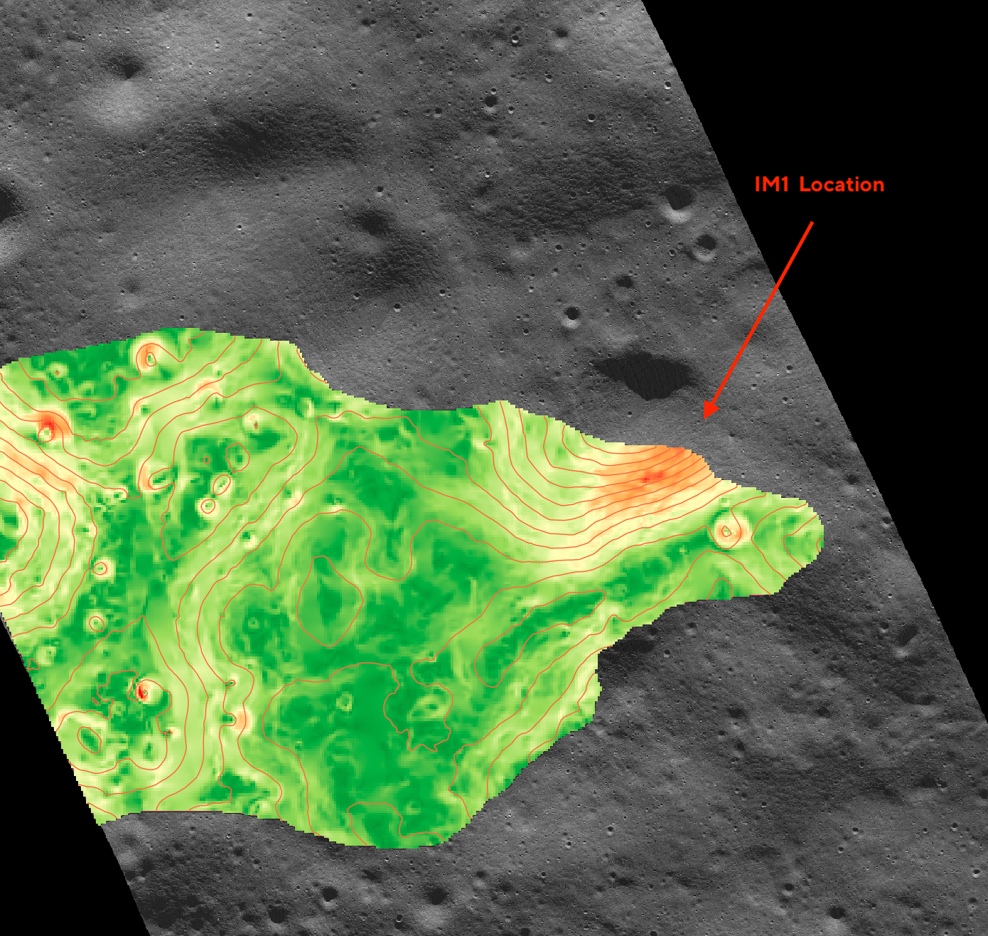
The Digital Slope Map data product has been color-shaded in QGIS using a pseudocolor map to highlight areas that are clearly flat, represented mostly by green. When overlaid on top of the terrain, it shows these flat areas surrounding the crater. However, the slope distribution of this location clearly indicates that it is predominantly not flat but, with slopes around approximately 7.5° and 12.5°.
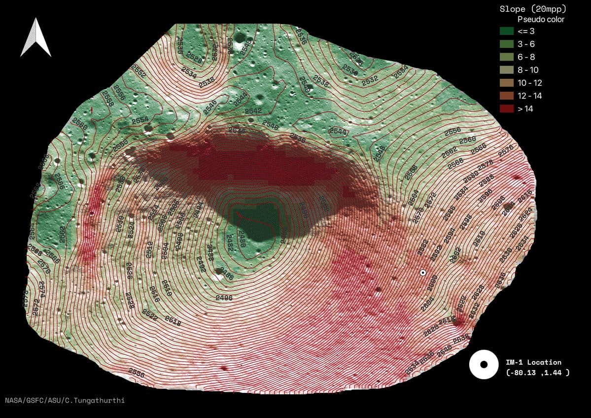
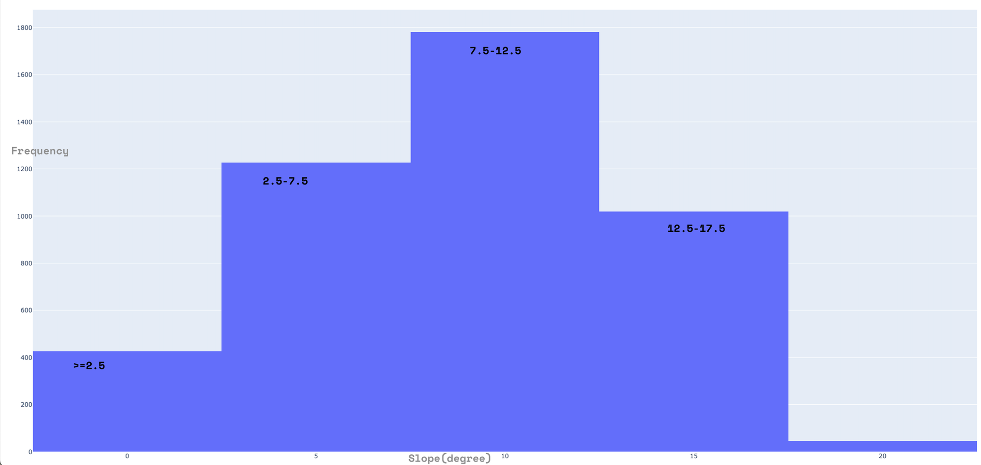
Slope distribution of the landing site of IM-1 Credits: NASA/GSFC/ASU/C.Tungathurthi
It is clear that this location is not the most suitable site for landing—not just because it is not flat and is close to a crater, but also because it is within proximity to an area that is indeed very flat.
How flat you ask?

Slope distribution of areas eastwards of the landing site of IM-1 Credits: NASA/GSFC/ASU/C.Tungathurthi
The regions eastward of the landing site are mostly flat, with the majority of slopes falling between 1° and 7°. This characteristic is indicated by the areas predominantly shaded in 'green'.
While it's clear that the Nova-C lander missed its intended landing site by 1.5 km, as mentioned in their tweet, the lack of transparency and detail regarding the precise target site raises questions. Without more forthcoming information, we are left to take their word at face value, which is less than satisfactory for a mission of this significance.
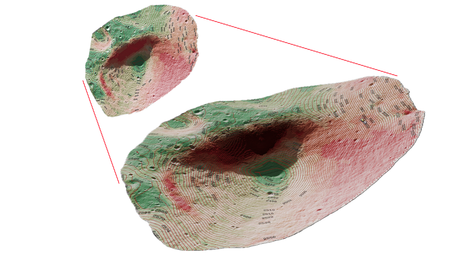
Given the elevation map, the LDEM data product provides sufficient resolution to generate a 3D topography of the crater, offering a unique perspective of the landing site.
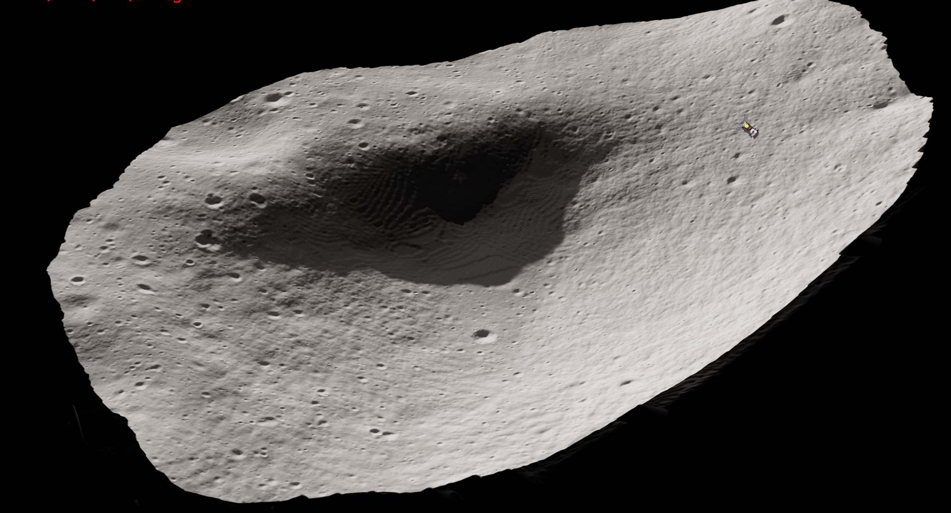
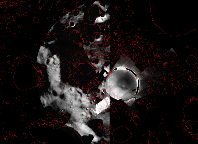
The high-resolution LRO NAC pair mosaic, M1435274280, was utilized as the terrain base in the analysis mentioned above. Each individual NAC image underwent calibration and stretching, and was later processed in QGIS to adjust brightness and contrast, thereby enhancing surface features.
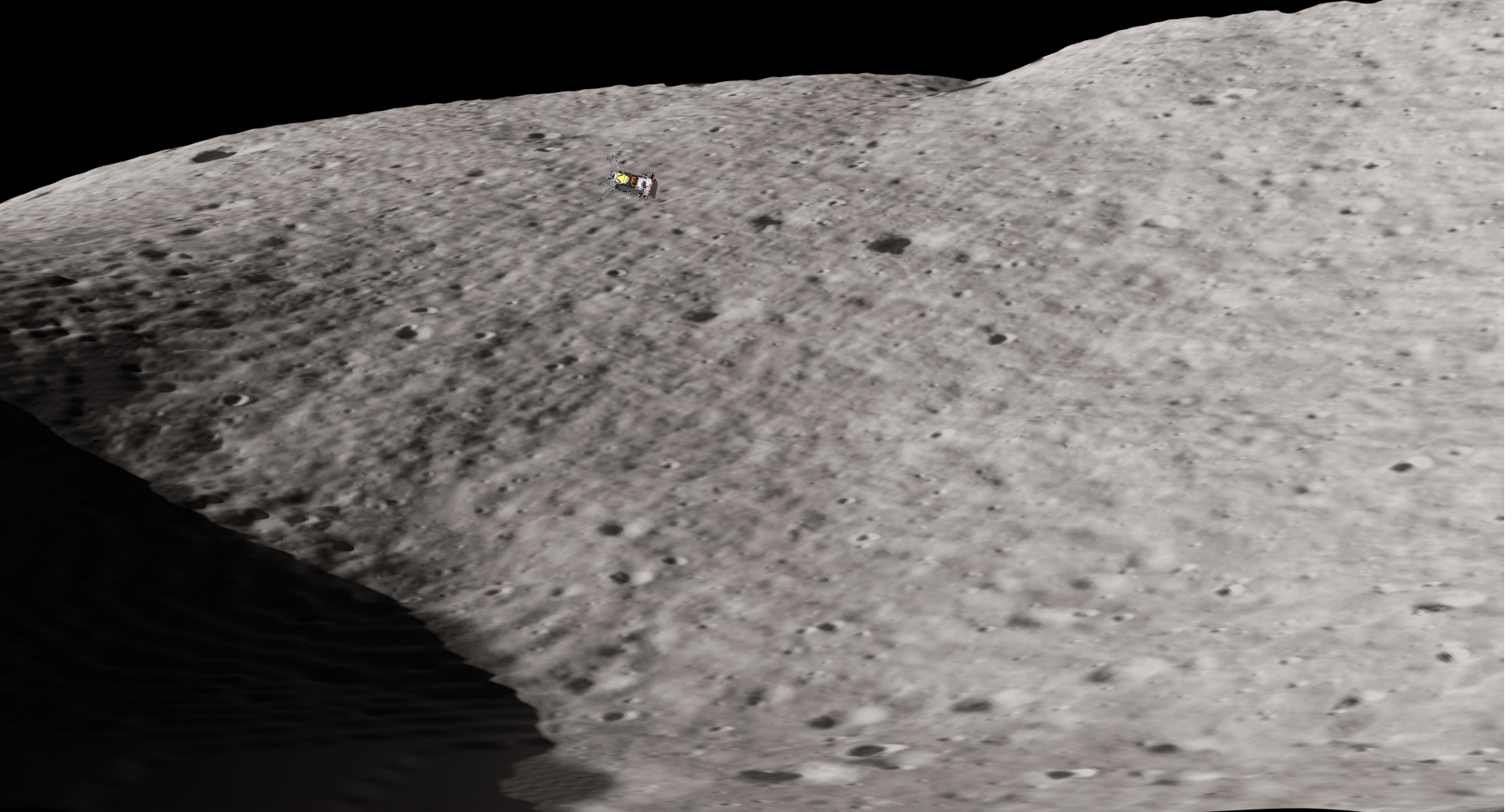
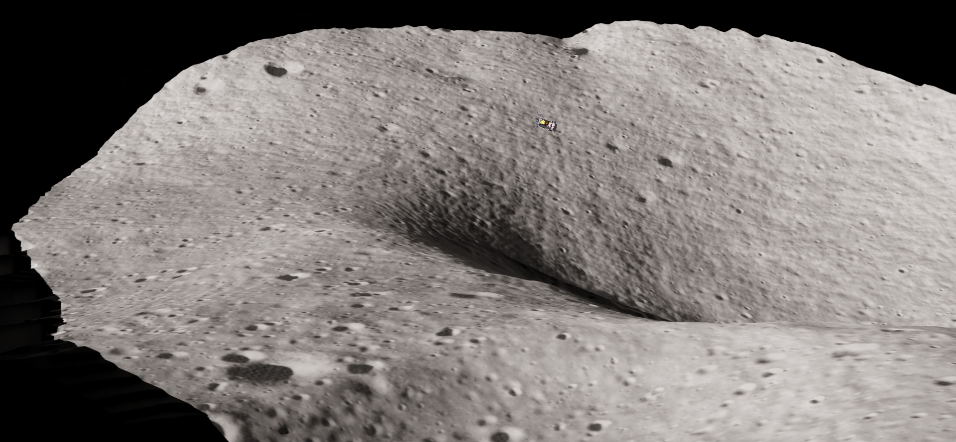
Credits: NASA/GSFC/ASU/C.Tungathurthi
An approximate location of the lander can be seen in these images, although the orientation is not accurate. Subsequent images shared by Intuitive Machines show the lander's legs facing towards the crater. In a follow-up post, I will share my thoughts on the approach trajectory of the lander and talk a bit more on the environment.
~FIN
Member discussion