Issues with Chandrayaan 2 Science data
This is a revised version of the document I originally submitted to ISRO’s Ahmadabad SAC. The purpose is to understand and hopefully resolve the issues observed in the shapefiles provided by ISRO for public dissemination.
The datasets currently available on the PRADAAN portal appear to contain errors, rendering them unfit for substantive analysis in cases where they occur.
Despite my efforts in reaching out through various channels, I have not received any response from ISRO Ahmedabad SAC to address these concerns. Hence, I am extending this inquiry to the wider scientific community and interested parties who may be able to assist.
- Primary Objectives of using the Dataset
- Potential Issues
- Demonstrative Dataset
- Appendices
- Special Thanks
Primary Objectives of using the Dataset
Search for points of interests within the full catalogue using Shapefiles
One of the important objectives is to explore the desired set of points of interest within the TMC2 dataset.
For example:
- Theophilus Crater: Lat: 11.4°S, Long: 26.4°E
At the moment, the most straightforward way is to search based on shapefiles. Spatial databases such as Spatialite and PostGIS facilitate this. Other mechanisms include "Search based on Corrected Coordinates" available via the ISSDC portal.
A potential usecase could be that a portal can be developed where the POIs can be searched within the dataset, for eg: Soma Unified Portal
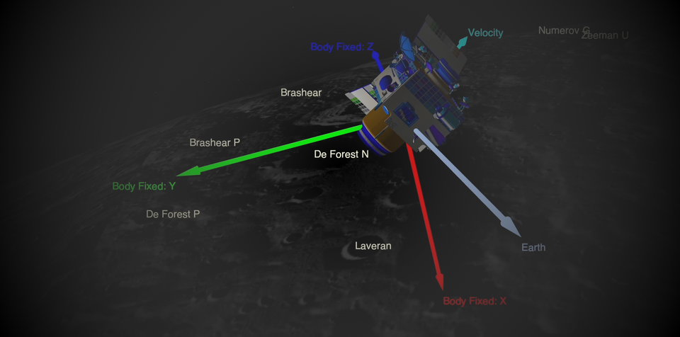
Building 3D-Topographic Models
Furthermore, both DEM/DTM and Orthographic dataset help in building a 3d topographic model of the POIs enabling better understanding of the sites. For this to work correctly, the DEM and Orthographic data need to have a good agreement matching both shape and dimensions within a minor margin of errors.
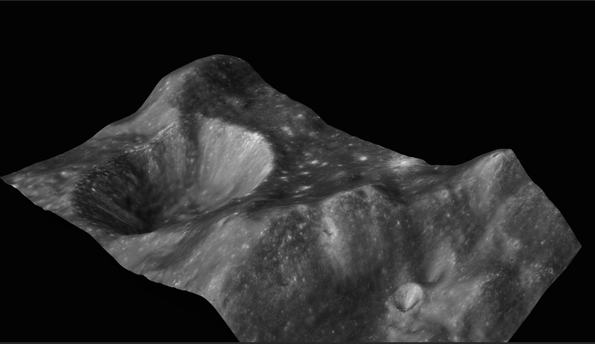
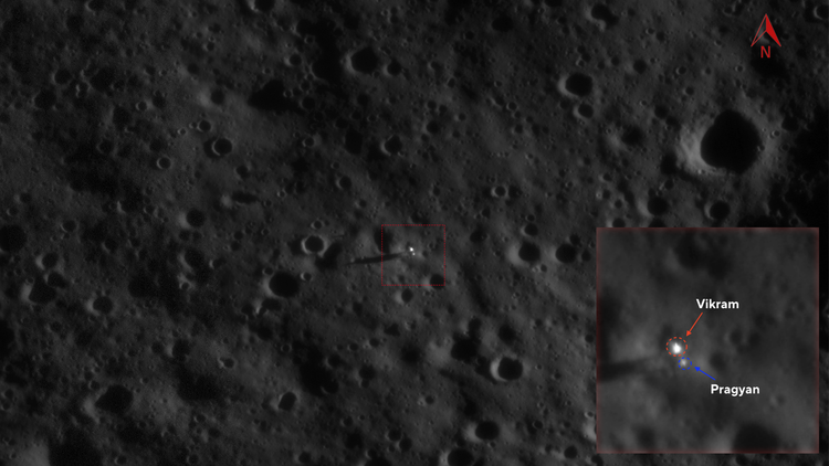
source: topograhy view of Chang'e 6 Landing site
Potential Issues
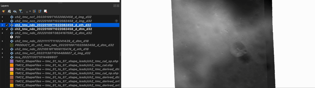
Issue#1: Erroneous Stray Data Observed Outside the Normal Image Data Strip
The default assumption is the data is going to come in a strip and the shapefiles indicate the boundaries of these strips. But in multiple cases it is observed that the images have erroneous "extra" data outside and far away from the strip which is causing shapefiles to extend far beyond the actual coverage. This makes searching and using the shapefiles impossible and renders shapefiles useless. You can observe this in the image the green shape polygon seems to be “stretched” outside the image. Note the extra junk data at the edge, I have indicated this error data in red arrows.
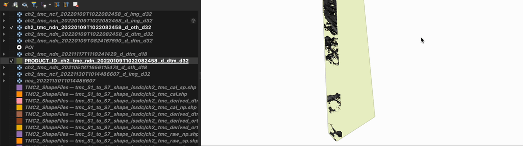
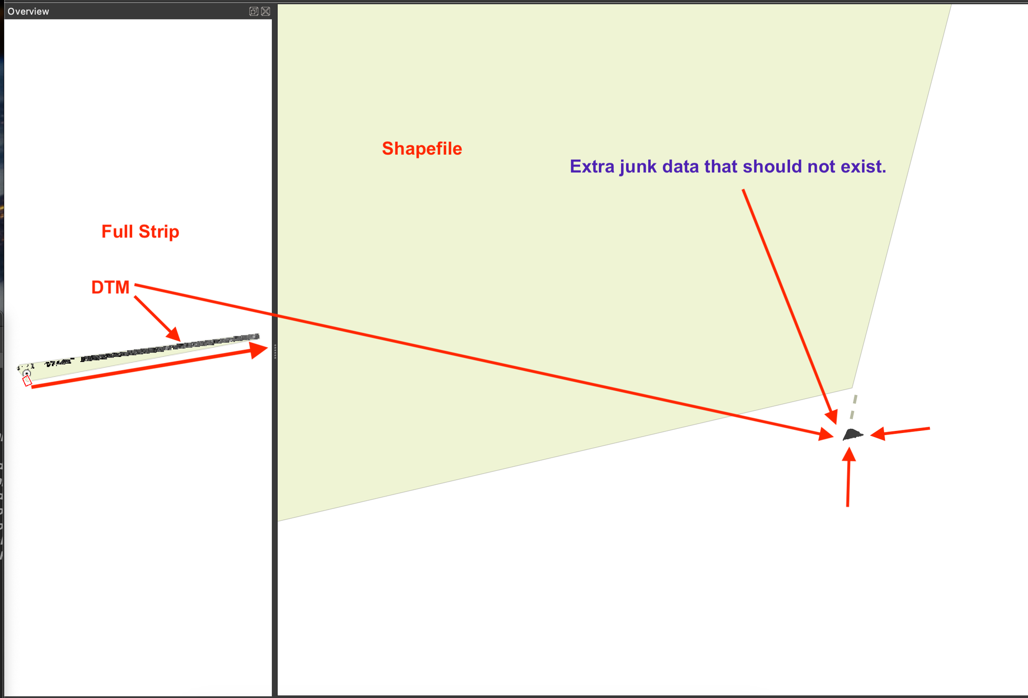
Is the stray data outside the normal image strip expected or a result of erroneous production during the derivation? I believe this stray data is the reason the shape is stretched out beyond the normal image strip and causing these issues.
Issue#2: Location Inaccuracy between DTM and Orthographic Images
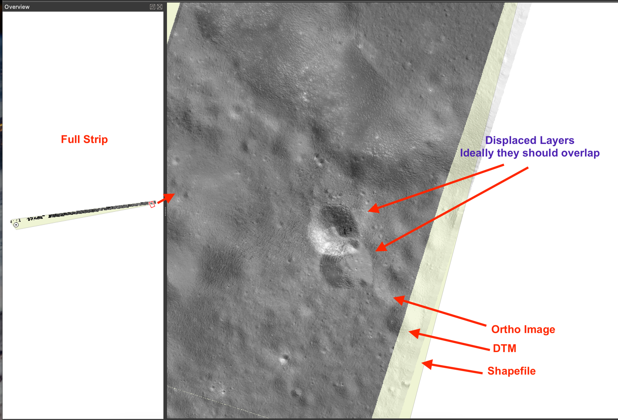
It is my understanding that the DEM/DTM and Ortho needs= to perfectly align to achieve a 3d reconstruction of a site and minor inaccuracy is still acceptable. However, in the above picture, you see there is a clear and notable mis-alignment (QGIS> go 136670.736, 874537.345). This would not result in an accurate 3d reconstruction of the site. This makes both of these files not useful at all. I have seen many in this condition.
What is also observable is that the mis-alignment is both in longitude and latitude. Could this be also a related issue during the derivation?
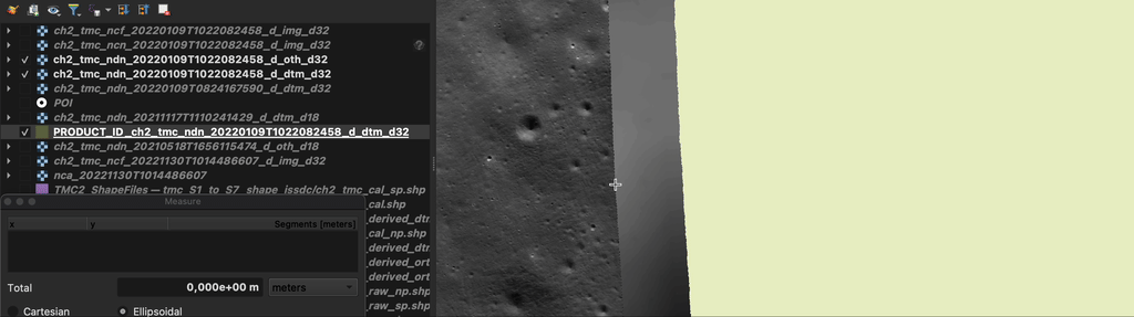
Issue#3: Mismatched Dimensions of DTM/Ortho and Shape Images
While the mismatched of shape file and derived products can be explained due to Issue#1, the DTM and Ortho image also do not match. In this product, the derived product differs by more than 1.5KM . This difference was observed in multiple products but it is inconsistent.

Possible Explanation & Disappointment
These issues (#1,#2, #3) tells me that there could be a potential bug during the derivation of certain data data products as these inconsistencies are not observed in all the data products.
Due to the lack of communication from ISRO, I can arrive to this conclusion that the current state of datasets provided can not be used for any meaningful analysis unless the bugs are fixed while generating derived products or shape files updated. My primary objectives seemed unresolved with the data provided as it is.
Demonstrative Dataset
To illustrate the data discrepanceis in the TMC2 dataset, I'm using the following dataset as a demonstrator - you can use this to replicate the issuse.
Shapefile: PRODUCT_ID_ch2_tmc_ndn_20220109T1022082458_d_dtm_d32
Derived Products / Level 2
- DTM:
ch2_tmc_ndn_20220109T1022082458_d_dtm_d32 - Ortho:
ch2_tmc_ndn_20220109T1022082458_d_oth_d32
Calibrated Products / Level 1
- Fore:
ch2_tmc_ncf_20220109T1022082458_d_img_d32 - Nadir:
ch2_tmc_ncn_20220109T1022082458_d_img_d32
Note: The "aft" sensor data from the ISSDC portal was not available at the time of drafting this document.
It is also observed that the CRS of shape files and that of derived products are in Polar Stereographic [CRS References]. For illustrations, QGIS is used with these CRS.
Note: use PRADDAN webportal to download the dataset.
Appendices
Some Background about the data
If you are completely new to #Chandrayaan mission and TMC2 dataset you can read it more here: Topographic Mapping Using TMC-2 of Chandrayaan-2
What softwares do I need to replicate the issues?
I primarily work on QGIS and to replicate the issues here, this should be enough for replicating and is only needed for all PDS4 datasets. For 3d rendering of the topography, I used Qgis2threejs plugin and Blender. In the limited context here, this is optional and is not neccessary.
CRS References
Shapefile CRS
$ ogrinfo -al -so PRODUCT_ID_ch2_tmc_ndn_20220109T1022082458_d_dtm_d32.gpkg
INFO: Open of `PRODUCT_ID_ch2_tmc_ndn_20220109T1022082458_d_dtm_d32.gpkg'
using driver `GPKG' successful.
Layer name: PRODUCT_ID_ch2_tmc_ndn_20220109T1022082458_d_dtm_d32
Geometry: Multi Polygon
Feature Count: 1
Extent: (-40285.300000, -32505.300000) - (906585.000000, 155464.000000)
Layer SRS WKT:
PROJCRS["POLAR_STEREOGRAPHIC_MOON",
    BASEGEOGCRS["GCS_MOON",
        DATUM["D_MOON",
            ELLIPSOID["MOON",1737400,0,
                LENGTHUNIT["metre",1,
                    ID["EPSG",9001]]]],
        PRIMEM["Reference_Meridian",0,
            ANGLEUNIT["Degree",0.0174532925199433]]],
    CONVERSION["unnamed",
        METHOD["Polar Stereographic (variant B)",
            ID["EPSG",9829]],
        PARAMETER["Latitude of standard parallel",-90,
            ANGLEUNIT["Degree",0.0174532925199433],
            ID["EPSG",8832]],
        PARAMETER["Longitude of origin",0,
            ANGLEUNIT["Degree",0.0174532925199433],
            ID["EPSG",8833]],
        PARAMETER["False easting",0,
            LENGTHUNIT["metre",1],
            ID["EPSG",8806]],
        PARAMETER["False northing",0,
            LENGTHUNIT["metre",1],
            ID["EPSG",8807]]],
    CS[Cartesian,2],
        AXIS["easting",north,
            ORDER[1],
            LENGTHUNIT["metre",1,
                ID["EPSG",9001]]],
        AXIS["northing",north,
            ORDER[2],
            LENGTHUNIT["metre",1,
                ID["EPSG",9001]]]]
Data axis to CRS axis mapping: 1,2
CRS Orthofile
$ gdalinfo ch2_tmc_ndn_20220109T1022082458_d_dtm_d32/data/derived/20220109/ch2_tmc_ndn_20220109T1022082458_d_dtm_d32.tif
Driver: GTiff/GeoTIFF
Files: ch2_tmc_ndn_20220109T1022082458_d_dtm_d32/data/derived/20220109/ch2_tmc_ndn_20220109T1022082458_d_dtm_d32.tif
Size is 94650, 18754
Coordinate System is:

PROJCRS["Polar StereoGraphic",
    BASEGEOGCRS["Polar StereoGraphic",
        DATUM["Moon_Spheroid",
            ELLIPSOID["Moon Spheroid",1737400,0,
                LENGTHUNIT["metre",1,
                    ID["EPSG",9001]]]],
        PRIMEM["Reference_Meridian",0,
            ANGLEUNIT["degree",0.0174532925199433,
                ID["EPSG",9122]]]],
    CONVERSION["Polar Stereographic (variant A)",
        METHOD["Polar Stereographic (variant A)",
            ID["EPSG",9810]],
        PARAMETER["Latitude of natural origin",-90,
            ANGLEUNIT["degree",0.0174532925199433],
            ID["EPSG",8801]],
        PARAMETER["Longitude of natural origin",0,
            ANGLEUNIT["degree",0.0174532925199433],
            ID["EPSG",8802]],
        PARAMETER["Scale factor at natural origin",1,
            SCALEUNIT["unity",1],
            ID["EPSG",8805]],
        PARAMETER["False easting",0,
            LENGTHUNIT["metre",1],
            ID["EPSG",8806]],
        PARAMETER["False northing",0,
            LENGTHUNIT["metre",1],
            ID["EPSG",8807]]],
    CS[Cartesian,2],
        AXIS["(E)",north,
            MERIDIAN[90,
                ANGLEUNIT["degree",0.0174532925199433,
                    ID["EPSG",9122]]],
            ORDER[1],
            LENGTHUNIT["metre",1]],
        AXIS["(N)",north,
            MERIDIAN[0,
                ANGLEUNIT["degree",0.0174532925199433,
                    ID["EPSG",9122]]],
            ORDER[2],
            LENGTHUNIT["metre",1]]]
Data axis to CRS axis mapping: 1,2
CRS DTM File
$gdalinfo ch2_tmc_ndn_20220109T1022082458_d_dtm_d32/data/derived/20220109/ch2_tmc_ndn_20220109T1022082458_d_dtm_d32.tif
Driver: GTiff/GeoTIFF
Files: ch2_tmc_ndn_20220109T1022082458_d_dtm_d32/data/derived/20220109/ch2_tmc_ndn_20220109T1022082458_d_dtm_d32.tif
Size is 94650, 18754
Coordinate System is:
PROJCRS["Polar StereoGraphic",
    BASEGEOGCRS["Polar StereoGraphic",
        DATUM["Moon_Spheroid",
            ELLIPSOID["Moon Spheroid",1737400,0,
                LENGTHUNIT["metre",1,
                    ID["EPSG",9001]]]],
        PRIMEM["Reference_Meridian",0,
            ANGLEUNIT["degree",0.0174532925199433,
                ID["EPSG",9122]]]],
    CONVERSION["Polar Stereographic (variant A)",
        METHOD["Polar Stereographic (variant A)",
            ID["EPSG",9810]],
        PARAMETER["Latitude of natural origin",-90,
            ANGLEUNIT["degree",0.0174532925199433],
            ID["EPSG",8801]],
        PARAMETER["Longitude of natural origin",0,
            ANGLEUNIT["degree",0.0174532925199433],
            ID["EPSG",8802]],
        PARAMETER["Scale factor at natural origin",1,
            SCALEUNIT["unity",1],
            ID["EPSG",8805]],
        PARAMETER["False easting",0,
            LENGTHUNIT["metre",1],
            ID["EPSG",8806]],
        PARAMETER["False northing",0,
            LENGTHUNIT["metre",1],
            ID["EPSG",8807]]],
    CS[Cartesian,2],
        AXIS["(E)",north,
            MERIDIAN[90,
                ANGLEUNIT["degree",0.0174532925199433,
                    ID["EPSG",9122]]],
            ORDER[1],
            LENGTHUNIT["metre",1]],
        AXIS["(N)",north,
            MERIDIAN[0,
                ANGLEUNIT["degree",0.0174532925199433,
                    ID["EPSG",9122]]],
            ORDER[2],
            LENGTHUNIT["metre",1]]]
Member discussion